Characterising the Landscape: 'Barrowlets'
This class of monument was first identified during the partner project Project 2804. Project 2804 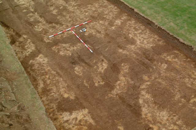 comprises the geophysical survey of the area between the present villages of East Heslerton and Sherburn. Somewhat less ambitious than this project and without the added value provided by the auger and topographic survey featured in this project; the results so far are nevertheless spectacular. comprises the geophysical survey of the area between the present villages of East Heslerton and Sherburn. Somewhat less ambitious than this project and without the added value provided by the auger and topographic survey featured in this project; the results so far are nevertheless spectacular.
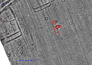
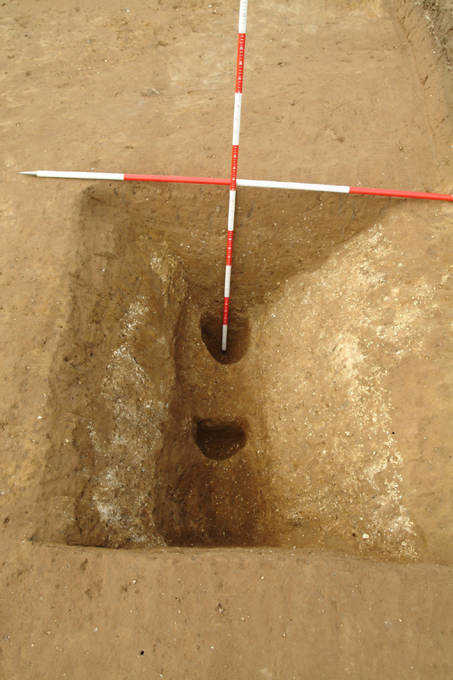
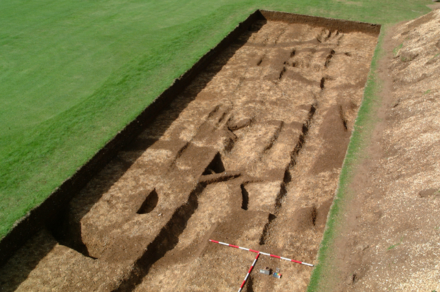 Barrowlets are, as the name implies, very small circular or ovate ditched burial monuments dated to the Late Iron Age and probably Roman Periods; they are found in regular association with the Ladder Settlement which follows the edge of the ancient wetlands as cemeteries, some of which appear to be enclosed. Excavation during 2001 included the examination of a number of these features which appear to be constructed using a narrow circular timber slot containing upright posts which retained a small mound made of material removed in digging the slot. The examples so far excavated had been badly plough damaged but fragments of cremated human bone indicate that they had contained cremations. It is likely that the cremated remains were buried on or near the old ground surface covered with the mound material, as such they are at the highest risk from plough damage. Excavation undertaken as part of project 3409 included the excavation of two small segments of a single ovate example on HPP Site 072. The two sample segments, dug to assess the nature of the feature and retrieve any dating evidence, failed to produce dating evidence but did confirm the use of timbering within the ovate slot which contained well defined post holes in the base of the trench. We know from the excavated samples shown in in the photographs above that only some of these features show in the geophysical survey, in the one trench where two features showed in the survey parts of ten were identified. So far the combined projects 2804 and 3409 have revealed more than 560 examples, it is likely that the real number is more likely to be 1500 or above within the 6.5km covered by the survey. Barrowlets are, as the name implies, very small circular or ovate ditched burial monuments dated to the Late Iron Age and probably Roman Periods; they are found in regular association with the Ladder Settlement which follows the edge of the ancient wetlands as cemeteries, some of which appear to be enclosed. Excavation during 2001 included the examination of a number of these features which appear to be constructed using a narrow circular timber slot containing upright posts which retained a small mound made of material removed in digging the slot. The examples so far excavated had been badly plough damaged but fragments of cremated human bone indicate that they had contained cremations. It is likely that the cremated remains were buried on or near the old ground surface covered with the mound material, as such they are at the highest risk from plough damage. Excavation undertaken as part of project 3409 included the excavation of two small segments of a single ovate example on HPP Site 072. The two sample segments, dug to assess the nature of the feature and retrieve any dating evidence, failed to produce dating evidence but did confirm the use of timbering within the ovate slot which contained well defined post holes in the base of the trench. We know from the excavated samples shown in in the photographs above that only some of these features show in the geophysical survey, in the one trench where two features showed in the survey parts of ten were identified. So far the combined projects 2804 and 3409 have revealed more than 560 examples, it is likely that the real number is more likely to be 1500 or above within the 6.5km covered by the survey.
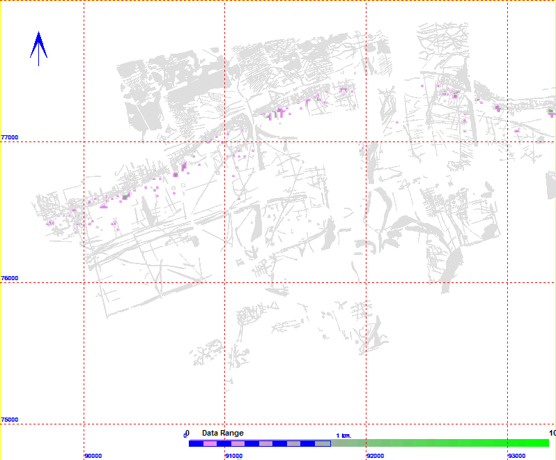
Map showing the distribution and density of barrowlets identified in project 3409, the coloured cells reflect density per 20m square with a maximum density of 10 per 20m square in green.
|
