|
|
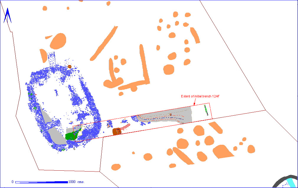
On the final day of the initial 2 week machine stripping in April, 1995, two trenches (012AF00001 and 012AG00001) were cut across the valley in order to establish the depth of hillwash at this point, and to see if the geophysical evidence showing a cessation of archaeological activity was correct. The trenches revealed a number of surprises, not the least of which turned out to be the late Roman structure seen in the plan above.
Initially, 12AF was a trench 35.5 metres long and 3 metres wide. A number of chalk blocks apparently forming part of a wall line were noted at the western end of the trench, and a piece of bronze sheet was seen in the eastern end. Following the discovery of a number of metal detector holes (the bronze sheet was also taken), it was decided to begin the excavation of this trench before the start of the season proper. The trench was cleaned and the level of archaeological survival was discovered to be very high. When the wall footing was fully uncovered, it was noted that it appeared to be curving slightly to the west. Further extension of the trench (by hand) found the western return of the wall. This discovery led to the opening up of the area between the trench and area 12AD, and the uncovering of the whole structure during the excavation season.
Due to time constraints, the whole area was not excavated (a high resolution geophysical survey was carried out), and the internal areas of the structure were cleaned, photographed and then backfilled with sand, preserved for future investigation.